
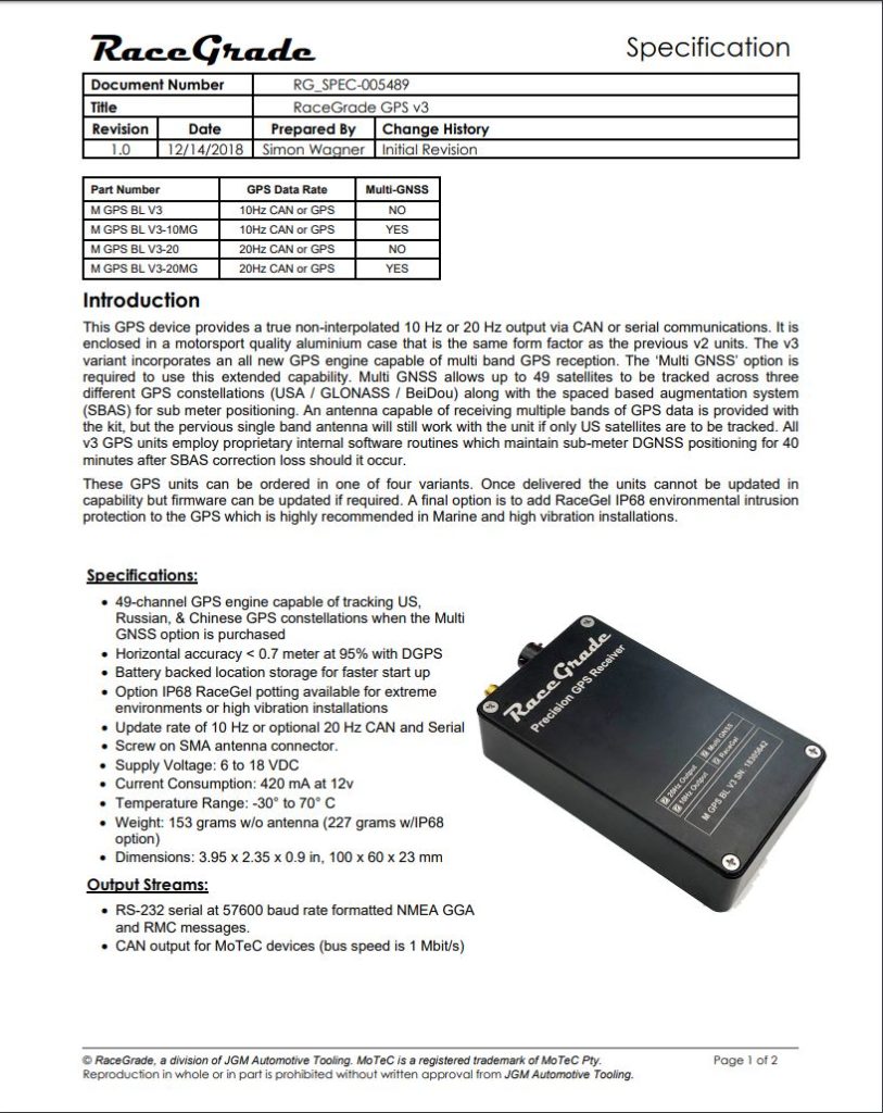
RaceGrade BL GPS V3 20hz
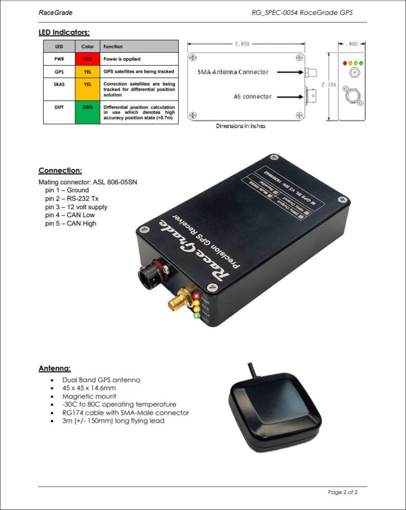
These units are drop in replacements for any current product. The exterior dimensions and connector types and pin-outs are identical. They are marked clearly as V3 units. They do require a new antenna for Multi GNSS capabilities, but can use pre-existing RaceGrade GPS antennas if they are not subscribed to Multi GNSS.
The basics are that the performance without the paid-for Multi-GNSS option will nearly identical to the V2.1 device with a few software perks.
With Multi-GNSS enabled the unit uses GPS, GLONASS and BeiDou;
-
- Tracks up to 12 US GPS satellites
- Tracks up to 12 GLONASS satellites
- Tracks up to 22 BieDou satellites
- Tracks up to 3 SBAS correction satellites in parallel
- Galileo and QZSS capable with firmware update
- All variants deliver high-precision, differential positioning accuracy of 60 cm, 95% of the time
- 67% of the time precision will be 30cm
- Consumer off the shelf GPS is typically no less than 2.5M
- COAST and SureTrack routines maintain sub-meter DGNSS positioning for 40 minutes after SBAS correction loss
*INCLUDES GPS ANTENNA
$1,299.00
Details
_Related Products


Contact Us
Have Questions or Need Professional Insight?
Comments & Reviews